


BOZEMAN – A weak disturbance is pushing up against the Continental Divide Monday afternoon and is digging to the South. This system will bring snow and some blowing snow through midnight Monday.

Area of concern right now is for those mountain passes on the Continental Divide, Boulder Hill, Elk Park, MacDonald Pass and possibly Homestake Pass. Snow accumulations at pass levels could be around 2”-4” through Tuesday morning.
The National Weather Service issued a WINTER WEATHER ADVISORY for the Butte/Blackfoot region through midnight Monday. Snow accumulations around 2”-4” is possible creating snow covered and icy roads. Butte could see several inches of snow.
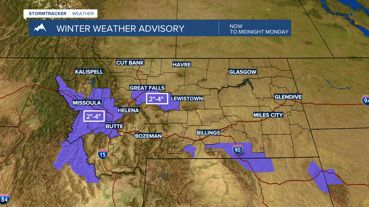
This system will bring areas of light snow to Bozeman and Bozeman Pass late Monday afternoon through the early evening hours. This could have a minor impact on tonight’s evening commute with falling snow, icy roads and lower visibility. Plan on wintry travel conditions for all mountain passes in SW Montana through Tuesday morning.
Another quick shot of snow is possible Wednesday evening into Thursday morning mostly east of the divide.
Temperatures this week will be near to slightly above normal.
