


BOZEMAN – A strong cold front will pass through the state tonight followed by a slower moving upper-level Low that should produce moderate to heavy rainfall over NW Montana through Wednesday afternoon.
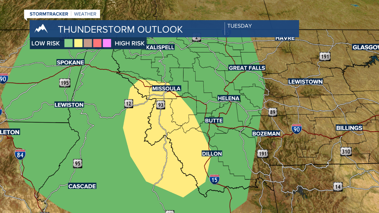
Locally, we will see scattered thunderstorms Tuesday evening, and some could be strong to severe.
The Storm Prediction Center has a “slight” risk for severe thunderstorms from Missoula to Dillon over to Salmon, ID Tuesday afternoon and evening. This means a few storm could produce damaging wind gusts and/or damaging hail.
There could be some localized areas of heavy rainfall associated with the thunderstorms over SW Montana but that is not expected to be widespread.
As the Low-pressure system spins into NW Montana tonight into Wednesday temperatures will fall well below normal especially daytime highs. Other impacts from this storm system will be increased surface wind gusts 30 to 50 mph across SW Montana Wednesday.

The weather pattern will settle down Thursday into Friday and the beginning of the long holiday weekend will be good as well but the next weather maker will arrive Sunday and bring another round of showers, thunderstorms, gusty wind, and cooler temperatures by Labor Day.
