

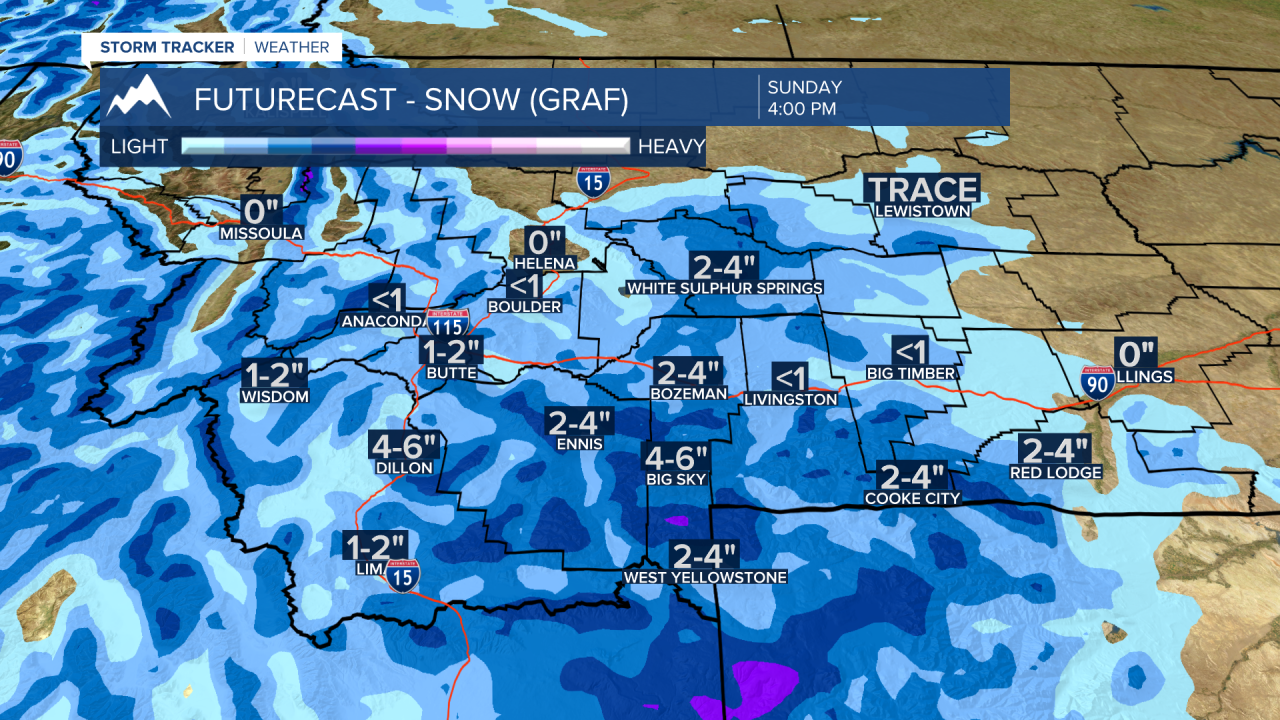
BOZEMAN – This weekend will be split between dry and mild to cold with snow. The next weather maker is a stronger Pacific cold front that will push into far western Montana by Saturday night and into SW Montana Sunday morning.
At the time I am writing this article Friday afternoon there are no winter weather highlights up with this storm, but snowfall forecast models are hinting at around 1”-4” of valley snow with possibly 4”-6” for most mountains and passes. Don’t be surprised if the National Weather Service issues an advisory or watch later today or Saturday for Sunday travel hazards.
Temperatures will be much cooler Sunday with highs only in the 30s. A rapid warming trend will begin Monday and temperatures should shoot well above normal by Wednesday of next week.
