

BOZEMAN – Severe winter weather continues to impact Montana and much of the region even behind the Arctic cold front that passed through Tuesday.
Considerable blowing snow and some drifting snow is creating hazardous travel conditions.
At the time of this report (1pm Wednesday) I-15 remains CLOSED Dillon southward but is open to locals heading northbound. US 20 is CLOSED in Idaho impacting travel over Raynolds pass and out of West Yellowstone. Severe driving conditions continue from Virginia City to Twin Bridges.
The National Weather Service continues a WINTER WEATHER ADVISORY through 6 pm Wednesday in the Bozeman area up through Helena and Great Falls. Areas of light snow continue but it’s the gusty surface winds that are producing considerable blowing snow.

The National Weather Service continues a WINTER STORM WARNING for southern Montana through 6 pm this evening. Light snow continues but stronger surface winds are producing whiteout travel conditions with gusts over 40 mph.

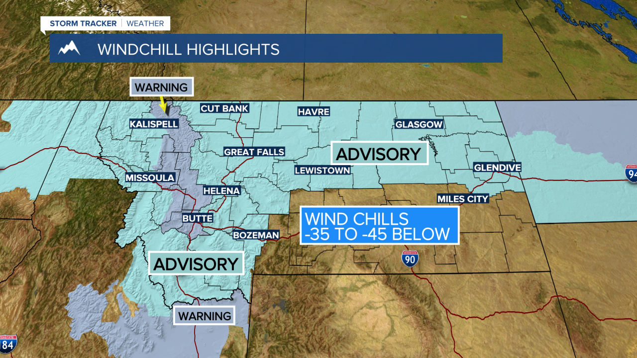
The National Weather Service has issued WIND CHILL WARNINGS and WIND CHILL ADVISORIES across most of Montana beginning Wednesday evening through Friday morning.
Feels like temperatures between –35 to –45 below zero are possible. Frostbite is possible within 10 minutes on exposed skin.
Forecast lows Thursday morning and Friday morning are between –10 to –25 below zero. By Saturday morning lows should be mostly above zero and forecast highs by Sunday could reach the mid 30s to lower 40s.


