

BOZEMAN – 6 more weeks of winter! Groundhog Day forecast from Punxsutawney Phill. I stepped outside this morning and said “yes more winter” with air temperatures well below zero.
Morning lows across SW Montana Wednesday morning bottomed out between –5 and –15 below zero with wind chills down between –15 to almost –40. One of the coldest feels like temperatures this morning was reported at Virginia City with a wind chill of –37 below zero.

Wednesday night temperatures will once again fall below zero for most reporting stations in SW Montana. But there is a catch. Clear skies early will allow temperatures to fall rapidly and by midnight we could reach our forecast lows. Increasing clouds overnight should help to bring some of those temperatures up by sunrise.
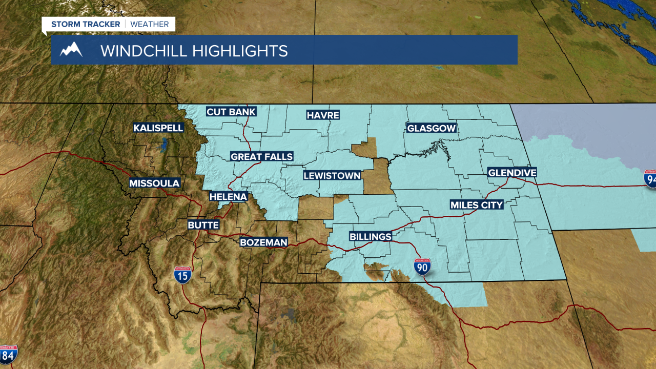
The National Weather Service continues WIND CHILL ADVISORIES for most of northern, central, and eastern Montana Wednesday night into Thursday morning. Wind chills could be extremely cold or colder than -30 degrees below zero.
Thursday will be a transition day as a warming west to SW flow aloft develops and kick off a warming trend. Temperatures will be colder than normal Thursday, but much warmer compared to Wednesday. Friday we should be back up to normal max temperature levels and by the weekend into early next back above normal with some lower 40’s possible Sunday through Tuesday of next week.
There will be some areas of snow over most of the mountain ranges Thursday into Friday with minor accumulations possible for a few select mountain passes. Overall, travel conditions will be improving beginning Friday.
