


Winter Storm Warning: A Winter Storm Warning is in effect through Saturday for higher elevation in Gallatin and Madison Counties. Pass level snow totals expected to be between 4”-8” with over 12” in the high mountains.
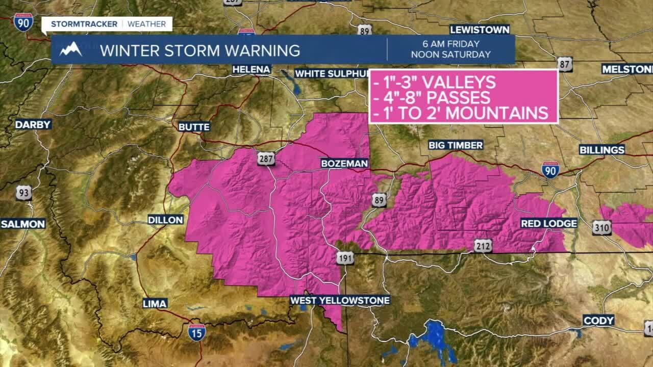
Winter Weather Advisory: A Winter Weather Advisory is in effect through 6 AM Saturday. Snow accumulations are expected to be between 2”-5” at pass level with up to 1” below 6000 feet.

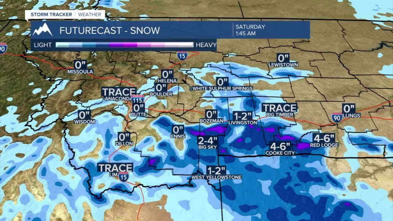
Today's Forecast: Mountain snow showers are dominating the forecast in southwest Montana and across Gallatin, Madison, and Park counties as well as in the Beartooth Mountains. High valleys could see between 1”-3” through Saturday while lower valleys, including the Gallatin Valley, will generally see trace amounts of snow with a rain/snow mix through the day. High mountains are expected to pick up anywhere between 1’-2’ of total snowfall. Temperatures will stay cooler with highs in the upper 30s to middle 40s.
BOZEMAN: High: 39; Low: 30. Chilly showers with a mix of rain and snow through the afternoon with light snow developing overnight. Accumulations will be limited in the valley with foothills picking up between 1”-3”. Expect slushy or wet driving conditions.
BUTTE: High: 43; Low: 29. Mostly cloudy and cool with an isolated shower possible. There is a chance of a few flakes mixing into the region.
DILLON: High: 40; Low: 28. There is a slight chance of a passing shower or two with a chilly breeze out of the north to northwest wind between 15-30 mph.
WEST YELLOWSTONE: High: 45; Low: 25. Wet with scattered snow showers possible through the afternoon and evening. Look for 2”-4” of fresh snow possible by Saturday.
COOL PATTERN ENDS AS WARMER TEMPERATURES NEXT WEEK: The monster snowstorm hitting the southern mountains of Montana and eastern Montana will move slowly to the east through the weekend. This will allow an area of high pressure to move back in and draw warmer air back into place starting on Sunday. While temperatures at the end of the weekend stay below average, we will begin to see that warming trend drift back above average early next week. Temperatures will approach the 60s by Tuesday before another cooler airmass moves in late Wednesday and Thursday.
