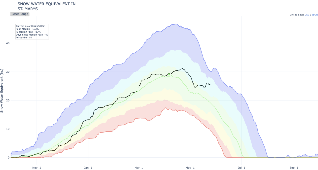
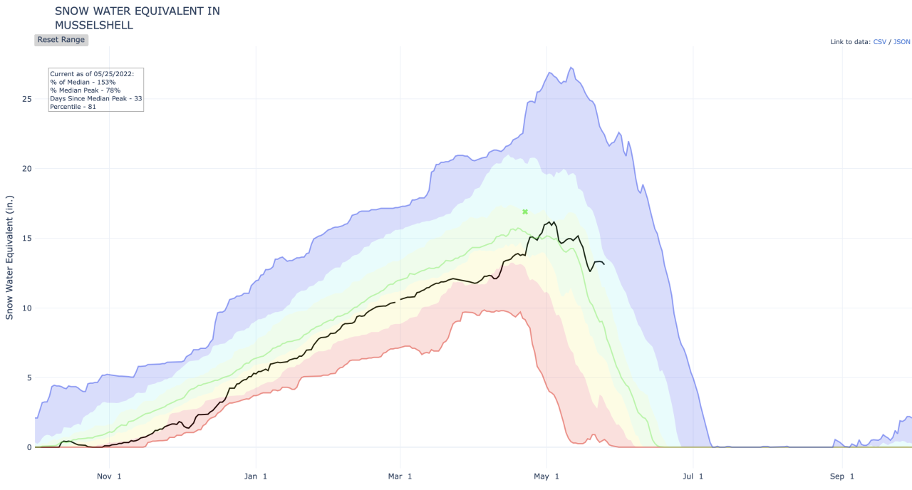
The continued cool and wet weather this spring continues to chip away at snowpack deficits accrued throughout winter and early spring. Central Montana mountain basins generally see snowpack values peak around early to mid April.
It is important to note snowpack percentage values become less and less reliable following the peak. Average snowpack values diminish during May and early June as temperatures warm, meaning a few inches above normal for a given date leads to very high percentage values. These snow amounts are not nearly enough to make up for the lack of precipitation during several, typically wetter months.
To get the best gauge on the status of mountain basins, it is best to look back at snowfall water equivalent throughout the entire water year (begins Oct. 1st). The black line indicates this water year's snowfall water equivalent and the green line indicated the 30-year median (1991-2020).

Areas west of the divide have maintained substantial precipitation throughout the majority of the water year thus far.


While areas east of the divide, particularly into southwestern Montana, have seen well below normal precipitation and snowpack levels throughout the majority of the water year.
The Musselshell basin reached its typical peak with about 78% of normal snowpack. It wasn't until late April when the cool, wet weather increased the basin's snowpack to above normal levels.
Sunny and warm weather may sound great as we head into the holiday weekend, however the cooler, wet pattern that looks to set up through the end of the month is exactly what is needed ahead of typically drier months.
TRENDING ARTICLES
- Lockdown at CMR High School
- Recalled peanut butter found in MT
- Montana State Fair adds Cheap Trick
- Slaughter denies 'extremist' charge
- Crumbl Cookies coming to Great Falls


