


BOZEMAN – A NW flow will persist this week with a few embedded cold fronts passing through producing mostly mountain snow and stronger surface wind gusts.
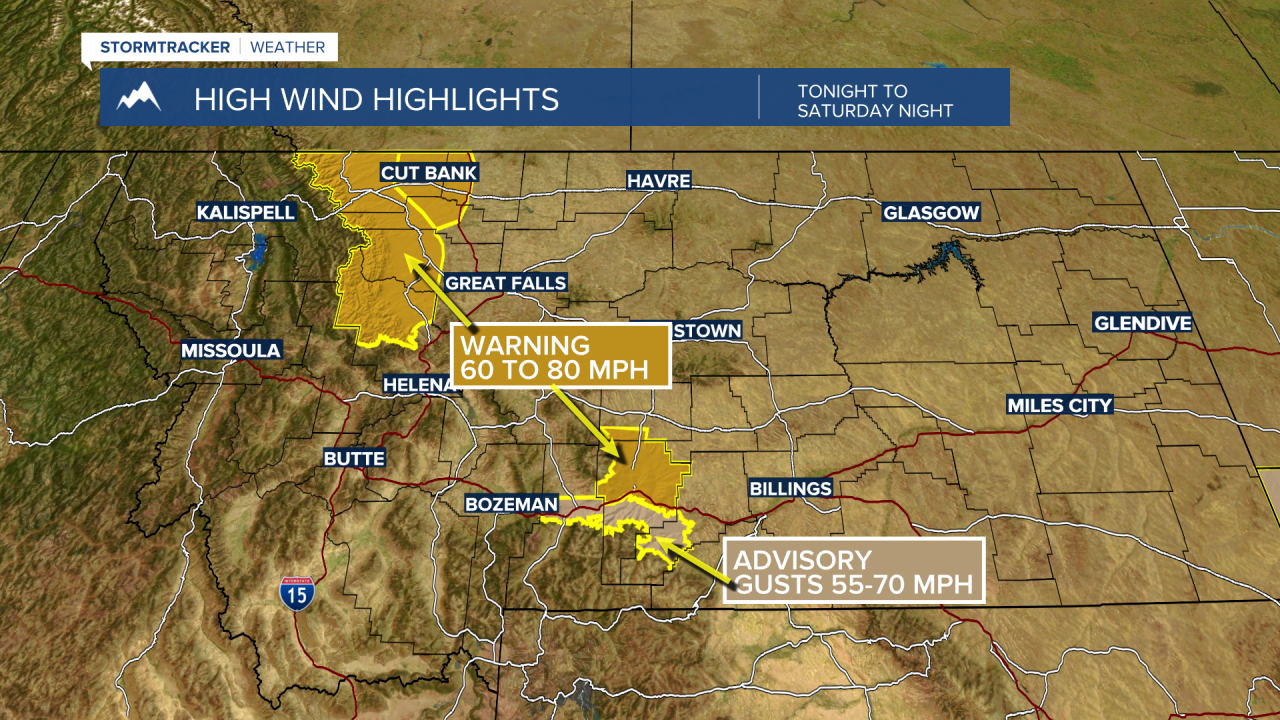
High wind areas across SW Montana could see peak wind gusts of 30 to 50 mph but classic high wind regions like Livingston and along the Northern Rocky Mountain Front could see gusts 60 mph or stronger.
The National Weather Service did issue Wind Advisories and High Wind Warnings tonight through Wednesday for those classic high wind belts. See graphic.
Temperatures will warm up ahead of the next cold front Tuesday and with increasing surface winds temperatures will be running slightly higher than normal.
Once the front passes through look for slightly cooler than normal temperatures beginning Wednesday with a slow warming trend by the end of the work week.
