

BOZEMAN – Arctic air covers the entire state and much of the western and central US today. One more extremely cold night for SW Montana and a warming trend begins Saturday.
As we transition into a milder pattern this weekend there will be increasing surface wind that will help scrub out the cold pools in the lower valleys, but it could also produce areas of blowing snow and low visibility travel hazards.
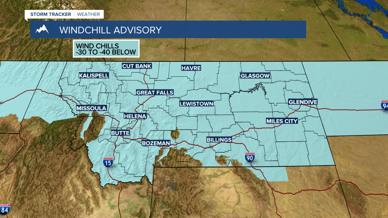
The National Weather Service continues a WIND CHILL ADVISORY across most of Montana through noon Friday. Feels like temperatures between –30 to –45 below zero are possible and frostbite is possible within 10 minutes on exposed skin.
Forecast lows Friday morning will be a little colder than Thursday morning as skies will be mostly clear tonight. In general, morning lows Friday will vary from –10 to –25 below zero and again wind chills –30 to –45 below zero are possible.

