

BOZEMAN – Another week for moisture and cooler than normal temperatures across Montana. This is a great pattern this time of year to help boost mountain snowpack.
There will be two storm systems to track this week. The first arrives Tuesday morning west of the divide and reaches Bozeman late in the morning into the early afternoon hours.
This first system will bring scattered valley rain or snow with minor snow accumulations possible for Butte. Mountains and passes will see periods of snow on Tuesday and could produce some slow-go travel conditions. The other weather impact with this first cold front will be increasing surface wind gusts. Locally, SW Montana could see a short burst of 30 to 40 mph gusts as the cold front passes through Tuesday morning into Tuesday afternoon.
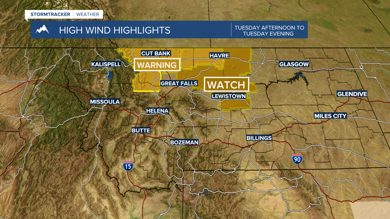
The National Weather Service did issue a HIGH WIND WARNING and a HIGH WIND WATCH for northern counties of Montana along the Rocky Mountain Front and adjacent plains. These areas could see gusts over 60 mph Tuesday.

Snow accumulations could be in the 2”-4” range between Big Sky to West Yellowstone and inside Yellowstone National Park. Just enough snow to produce some wet roads that could become icy Tuesday into Wednesday morning.

A second system looks more powerful, and that storm will begin to increasing rain, snow, wind, and cooler temperatures starting Thursday.
