


BOZEMAN – A slightly milder weather pattern will continue into Friday with forecast highs in the 60s but a cold front will knock temperatures down into the 40s by Saturday morning.
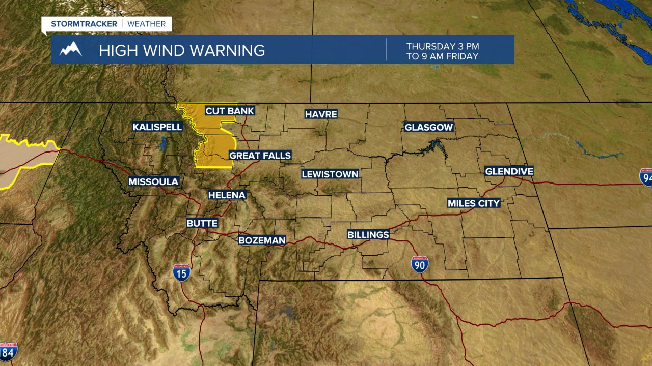
The next weather maker is a warm front and cold front combination. First, the warm front today into Friday and mild overall temperatures for Montana. This is also producing very strong downsloping wind gusts along the Rocky Mountain Front where a HIGH WIND WARNING is up through Friday morning.
Peak wind gusts could be over 70 mph through Friday morning (see graphic).
A cold front will begin to dig into NW Montana Friday afternoon and that front will sink to the SE Friday night into Saturday morning. A quick shot of rain or snow is possible with the frontal passage Friday night into early Saturday morning and some local mountain passes could see light snow by sunrise Saturday.
Once the front passes through a cooler NW flow aloft will develop producing chilly temperatures all weekend into early next week.
