BOZEMAN – Finally temperatures are moderating and should continue to rise through Sunday afternoon. The flow aloft has changed and is now out of the WSW and this is scrubbing out the cold pools from last week's Arctic intrusion.
The next weather maker is a Pacific cold front arriving Sunday afternoon producing increasing wind and scattered snow showers by Sunday night into Monday morning. East of the divide is looking favorable for accumulating snow, and it could impact your Monday morning commute.

Temperatures will be trending cooler again behind this front into early next week.
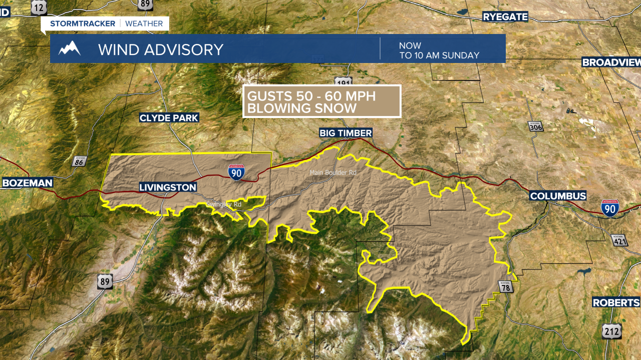
The National Weather Service has extended the WIND ADVISORY for the Livingston area through late Sunday morning. Gusts of 40 to 60 mph are possible and there could be some minor areas with blowing snow.