


Today's Forecast: Arctic temperatures are moving into the area, and we are expecting another blast of winter weather for Tuesday. Light snow showers will develop during the afternoon with the heaviest snow developing near sunset and pre-dawn on Wednesday. Accumulations will be lighter in Beaverhead County and near the Montana and Idaho state line. Highs today should make the upper teens and low 20s before snow showers pick up through the afternoon and evening.
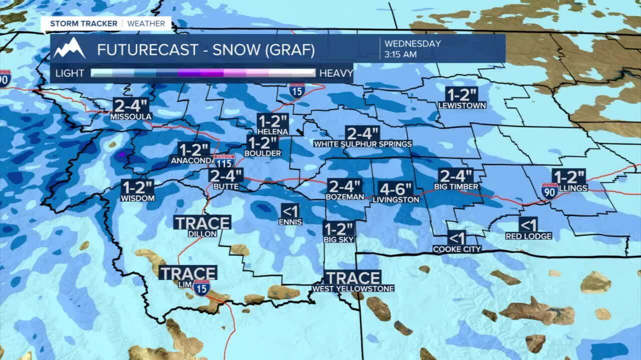
BOZEMAN: High: 21; Low: -5. Cold air will continue to press into the region today bringing a light dusting of snow by 5 PM and heavier bands of snow overnight. Winds will primarily stay light and out of the northwest 5-10 mph. Total accumulations by Wednesday morning are expected to be between 1”-3”.
BUTTE: High: 22; Low: -8. Slick roads early with bands of snow developing during the afternoon and evening. Accumulations by 5 PM should be near 1” with a total between 1”-3” by early Wednesday.
DILLON: High: 22; Low: -3. Chilly with clouds lingering for the afternoon. Light snow is possible for the evening with less than 1” of accumulation expected by Wednesday morning.
WEST YELLOWSTONE: High: 18; Low: -12. Cold and spotty snow showers late in the afternoon with light accumulation less than 1” early Wednesday morning.
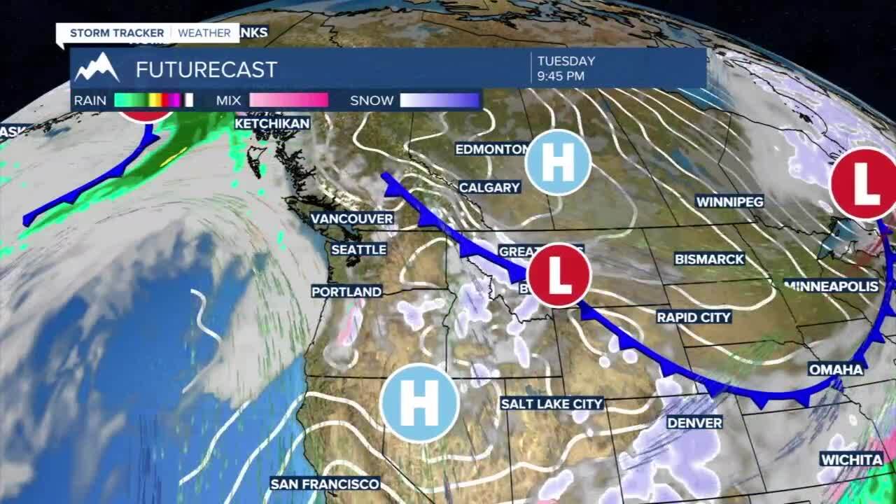
ARCTIC AIR IN PLACE THROUGH MID-WEEK: Arctic air is extending across the United States and will create some significant snow in the breadbasket of the country. That cold air is bringing a glancing, but significant blow to western and southwest Montana. Overnight lows on Tuesday and early Wednesday morning will be below zero. Highs on Wednesday will struggle to make it to the low teens. Highs will eventually work back to the 30s for the weekend and 40s by early next week.
