

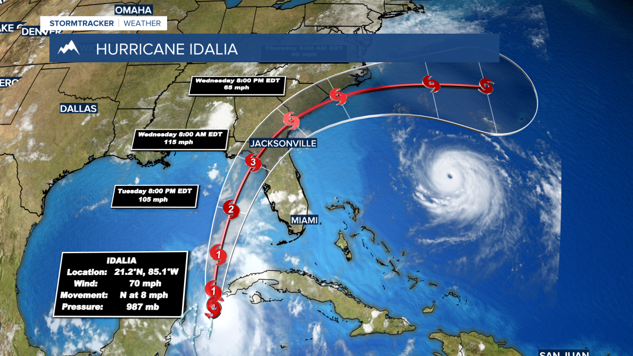
BOZEMAN – A major hurricane is set to impact northern Florida and southern Georgia by Wednesday with a possible category 3 or 4 storm. Hurricane Idalia is currently building off the west coast of Cuba and is expected to lift directly northward over the next couple of days.
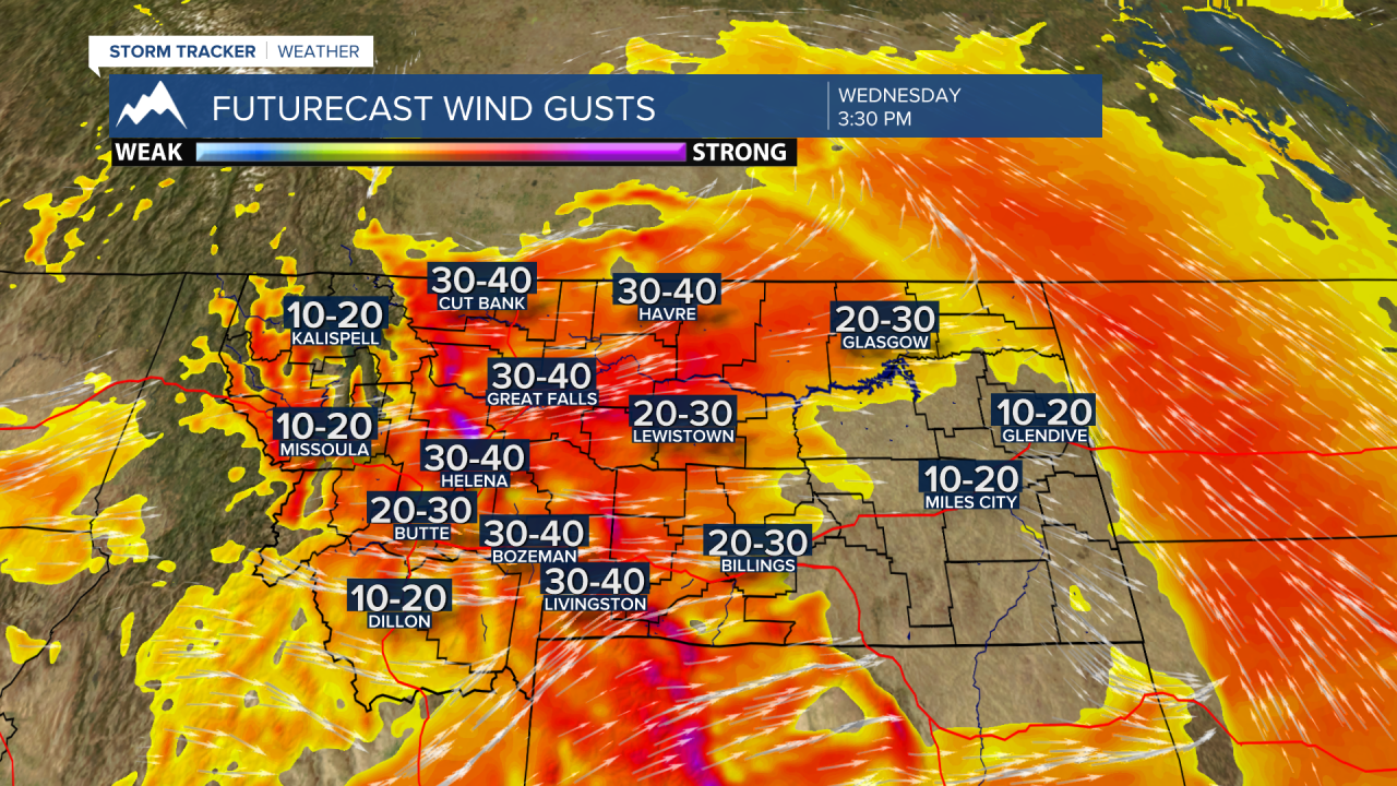
Back here in Montana we will be dealing with our own storm system that will bring stronger thunderstorms with areas of moderate to heavy rainfall, gusty surface winds and cooler temperatures.
The area of greatest concern will be NW Montana with an area of Low-pressure spinning through that part of Montana producing a higher probability of moderate to heavy rainfall through Wednesday morning.
Forecast models are estimating a half an inch or more of possible precipitation for NW Montana which is welcome news especially regarding the Severe Drought status in that part of the state.

SW Montana could see some scattered thunderstorms out of this storm system with a Marginal risk for strong to severe thunderstorms Tuesday afternoon along and west of I-15. Roughly from Dillon to Butte to Helena westward there could be a few strong to severe thunderstorms Tuesday afternoon.
As the Low begins to eject out of Montana and lift up into Canada surface wind gusts will begin to increase across the entire state Wednesday. Along the Rocky Mountain Front gusts over 50 mph are possible and locally in SW Montana high wind areas could see gusts 30 to 50 mph on Wednesday.
Forecast models are showing a new round of cool and wet weather moving over SW Montana late on Labor Day Weekend.
