The above on demand STORMTracker video forecast with Meteorologist Carson Vickroy will walk you through the forecast hour by hour for next 24 hours so you can have an idea of what the start of your week will look like.
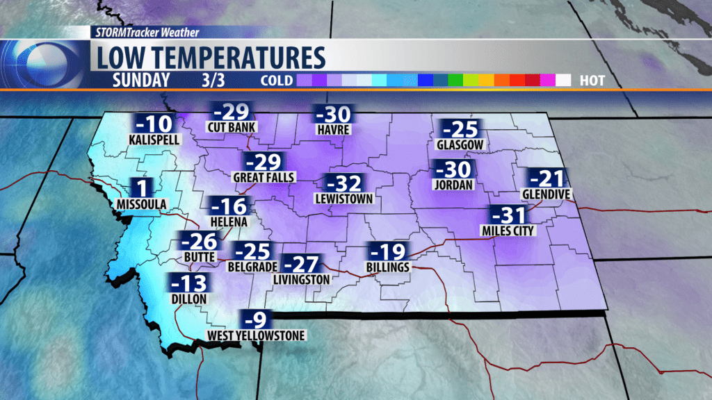
Here’s a look at our lows this morning. Some locations in SW Montana picked up records while others did not. We’ll have a full list of cities that broke records later this evening.
City by City Forecast:
BOZEMAN: LOW: -18°; HIGH MONDAY: 6°. Mostly clear this evening with cold temperatures remaining in place. Bitterly cold lows are expected tonight. Highs might get back into the single digits by tomorrow afternoon with more sunshine.
BUTTE: LOW: -35°; HIGH MONDAY: 11°. Extremely cold temperatures are expected with wind chills falling to 40 below at times. We’ll see warmer and dry conditions tomorrow afternoon. We’ll still be well below average.
DILLON: LOW: -13°; HIGH MONDAY: 10°. Another very cold, potentially record breaking night is expected. We will remain dry tomorrow afternoon and may crack the 10 degree barrier Monday evening.
WEST YELLOWSTONE: LOW: -14°; HIGH MONDAY: 23°. Cold and dry weather is expected for west tonight. We remain dry tomorrow with a warmer afternoon expected.
NEXT WEEK
Below average temps are expected for the entire week. We’ll remain dry through Tuesday. A more active weather pattern is expected starting Wednesday with snow chances back in the forecast. Stay tuned for more updates from the KBZK and KXLF STORMTracker weather team.
