BUTTE – Several pacific storms will continue to impact the western half of the country including Montana through early next week.
First storm system is here now and has been producing scattered snow mostly over nearby mountain ranges and occasionally a few snow showers down in the valley floor. This off and on snow pattern will continue into tonight and begin to taper by Friday late morning.
A second pacific storm that is currently down near Hawaii will roll into the Western U.S. beginning tomorrow and hit Montana beginning Sunday morning. This storm has abundant moisture and is warm cored so there is a chance for valley rain or snow Sunday changing to all snow Sunday night into Monday. This storm will impact travel locally and regionally this weekend into early next week.
WINTER WEATHER ADVISORY:
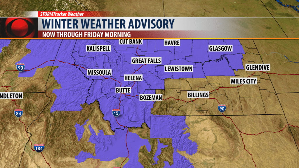
The National Weather continues a Winter Weather Advisory for Western, Central, Northern and SW Montana tonight into Friday morning.
Snow accumulations: Valleys 1″ – 3″ is possible but most likely 1″ or less. Mountains and passes could see 3″ -10″ of snow and a greater impact on traveling.
Localized gusty winds could also produce some blowing snow and reduced visibility tonight into Friday morning.
Areas impacted: The biggest impacts will be for those mountain passes on the MT/ID/WY state line tonight into Friday.
WINTER STORM WARNING:

The National Weather Service continues a WINTER STORM WARNING for NE Idaho including the Island Park, ID area and Highway 20.
Snow Accumulations: 6″ – 12″ is possible.
Gusty winds will produce areas of blowing and drifting snow into Friday afternoon.
City by City Forecast:
BOZEMAN: LOW: 20°; HIGH FRIDAY: 37°. Mostly cloudy with scattered snow showers tonight into Friday morning. Mostly cloudy Friday with scattered snow showers mostly in the morning and clearing by Friday evening.
BUTTE: LOW: 17°; HIGH FRIDAY: 34°. Mostly cloudy with scattered snow likely tonight into Friday morning. Little to no accumulations likely. A few off and on flurries are possible Friday with clearing skies by early evening.
DILLON: LOW: 19°; HIGH FRIDAY: 36°. Mostly cloudy with a few flurries tonight into Friday. Nearby mountains and passes have a better chance for scattered snow with accumulations and travel impacts tonight through Friday morning.
WEST YELLOWSTONE: LOW: 14°; HIGH FRIDAY: 29°. Scattered snow is likely for West Yellowstone with several more inches possible tonight into Friday morning. More snow is coming this weekend and early next week.
